Allensmore is made up of three main settlements: Allensmore itself, along with Cobhall Common and Winnal. These small settlements are interspersed with working farms and smaller groups of houses. The settlements of Cobhall Common and Winnal are documented in the Domesday Book of 1086 with the former having thirteen households and the latter eight. At that time, the Allensmore settlement was a wasteland on the edge of Haywood Forest and did not come into being until Alan de Plukenet, who held the manor of Kilpeck started to drain the land for agricultural purposes in the late 13th Century.
Over the centuries, agriculture was, and still is, at the heart of parish life with the Pateshall family owning the manor and its tenant farms from 1725 to 1958. The family also provided the village school which is now used as a community hall and renamed The Pateshall Hall in their honour. When Allensmore Court – the ‘big house’ – was demolished in 1958, a number of the farms came into the ownership of estate workers whose descendants still farm in the area today, some having recollections of life on the estate.
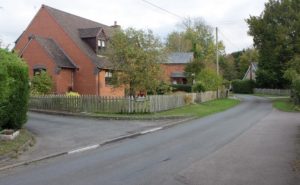
Parishioners value the rural way of life and the green tapestry of fields and small areas of woodland that link the settlement areas. They enjoy the listed buildings across the area along with a wide variety of more modern property. Housing has evolved over the years with the 1891 census recording around 142 houses and 520 residents to 1981 when there were around 156 houses and 446 residents. In 2011 there were about 230 houses concentrated in the three settlements and dispersed over a wider area, with a population of 566. There is no street lighting in any part of the parish giving dark skies valued by residents.
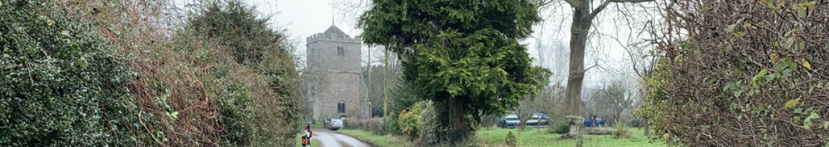
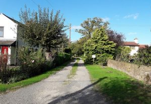
The village of Allensmore lies to the east of the A465 and is linear in nature. It has as its focal point the church of St Andrew. Whilst the south doorway of the church is Norman, most of the church today dates from the 14th century with a 15th century tower which has a peal of 6 bells and a band of enthusiastic bell ringers. The vestry window depicts the Pateshall family crest. The housing in this part of the neighbourhood area has a rich and varied mix of styles including 15th century listed buildings, Georgian farms edging the settlement, converted barns and 20th century bungalows and houses. Most of the housing stock is detached. There are no other services in this part of the village, including at present broadband.
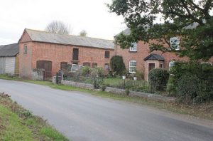
The hamlet of Cobhall Common lies to the west of the A465 and the settlement is linear in nature with buildings set back and lining the narrow lanes. Much of the housing is fragmented by fields belonging to farming families, some of whom have worked the land for several generations. Like the Allensmore settlement, Cobhall Common has a variety of housing styles, including the oldest house in the area (Little Cobhall Farm which has a cruck roof). Most of the housing stock in Cobhall Common is detached with single and two storey dwellings. On the fringes of Cobhall Common are working farms and small holdings together with allotments provided by a local farmer for the use of villagers. A bus runs through Cobhall Common once a week. The decommissioned telephone box has recently been converted into a mini community library called ‘Books in a Box’. Superfast broadband arrived in parts of Cobhall Common in 2017.
The medieval settlement of Winnal is believed to have developed on land associated with Winnal Farm. Housing stock is derived from four original farm houses, one of which is no longer a farm house. The oldest of these buildings is Winnall Court, parts of which date from the 17th century. Other housing in Winnal includes a cottage, a bungalow and some 1980s dwellings.
Winnal Common has two farm houses interspersed with cottages, bungalows and more recent residences. Winnal Common is separated from Cobhall Common by Winnal Common Farm.
Other small settlements in the area are Webtree, Mawfield, Hungerstone and Goosepool. More dispersed dwellings in the parish include farms, small holdings and cottages together with a few more modern individual houses.
Community buildings are limited to the village hall and church. Although the village hall does not lie within any of the three main settlement areas, being situated on the east side of the A465, it provides an excellent resource for the area, including bringing economic benefits. Keep fit, ballet, Women’s Institute meetings and other events are run from the hall, providing an additional income opportunity for those organizing some of the events, as well as providing local classes for the community.
As well as its regular weekly congregation of worshippers, the church has been used over the years for coffee mornings and for secular events, Barn Dances, a Ceilidh and Morris Dancing: a large open space being created by removing the pews. The absence of basic facilities, such as a toilet and kitchen, and indeed any running water other than at the church gate, together with a lack of car parking, hamper more extensive use of what is the largest public covered space available in the parish.
There are 23 statutorily listed buildings in the parish including the Grade II* Church of St Andrew, and the remainder Grade II, including various farm houses, a milestone and a water pump (the full list is provided in Appendix II).
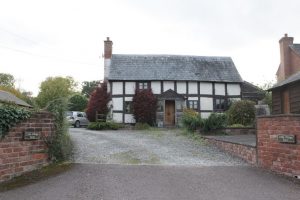
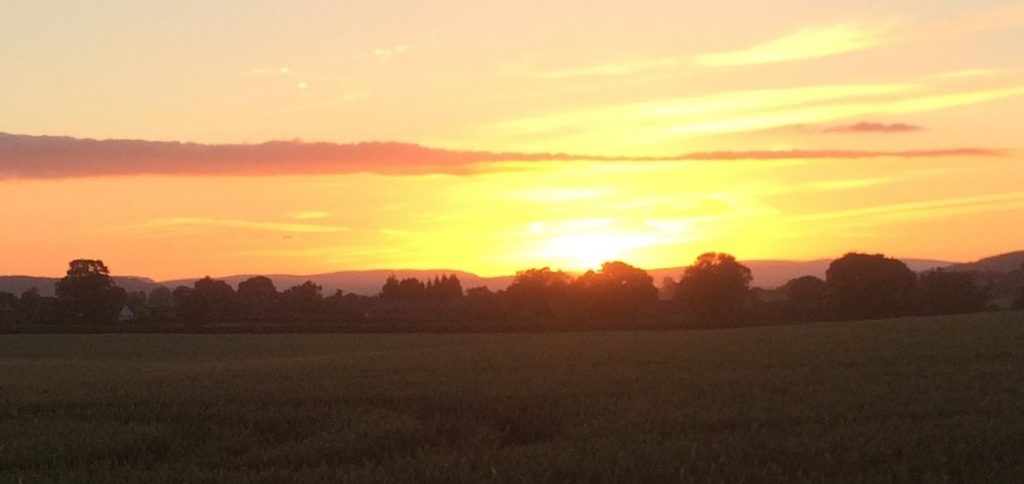
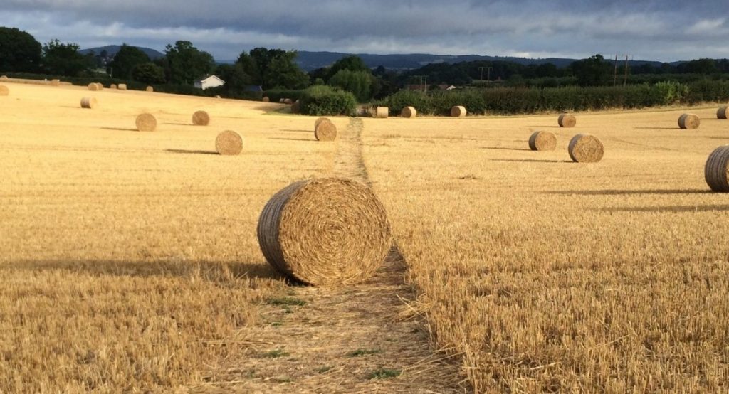
Allensmore is in National Character Area 100 Herefordshire Lowlands which has a tranquil and rural character with a generally flat and low-lying landscape of mixed arable farming and livestock surrounded by more distant hills such as The Black Mountains. There is still evidence of traditional orchards in the area. Smaller domestic sized orchards are in evidence across the parish. Surrounding hills are dominated by ancient woodland of ash and field maple or oak and bracken and small-scale woodland is a prized landscape feature due to its aesthetic impact and benefits for drainage and wildlife. There is a dispersed rural settlement pattern with traditional timber framed black and white buildings, and stone and red brick are widespread as local building materials. More locally, the Herefordshire Landscape Character Assessment 2004, updated 2009 identifies the following landscape types in Allensmore: Principal Settled Farmlands (across almost the entire area), with an area of Wet Pasture Meadow to the south east and Wooded Estate Land to the north.
A number of ponds can be found across the parish and these support wildlife and aid drainage.
In terms of local wildlife interest there are a number of traditional orchards all around the area and an area of ancient woodland in the south western corner.